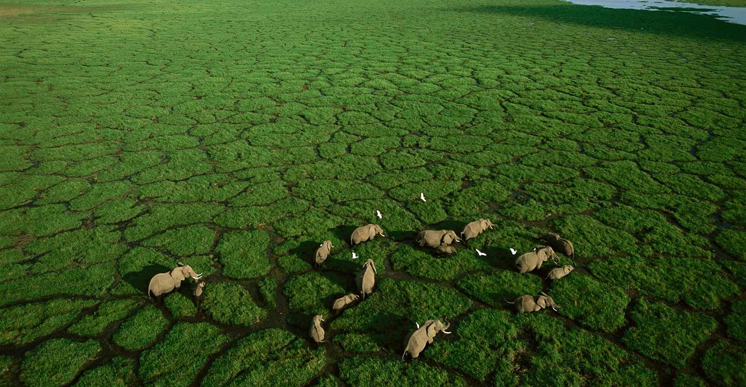
KEA is proud to be a leader in aerial surveys and orthophoto-mapping. For many years KEA have produced orthophoto maps for traditional requirements such as National Land surveys, agricultural projects, infrastructure development and border security.
Combining our Visionmap A3 Edge aerial mapping equipment
with facial recognition software we are able to
achieve worlds most accurate animal census.
However, we have now managed to combine our Visionmap A3 Edge aerial mapping equipment with facial recognition software. The result is the worlds most accurate animal census. During the months of June and July KEA performed surveys over Murchison Falls national park in Uganda. By mapping the entire park in ultra high resolution we are then able to run the pictures through our bespoke software and it will count all the visible animals in the park automatically.